
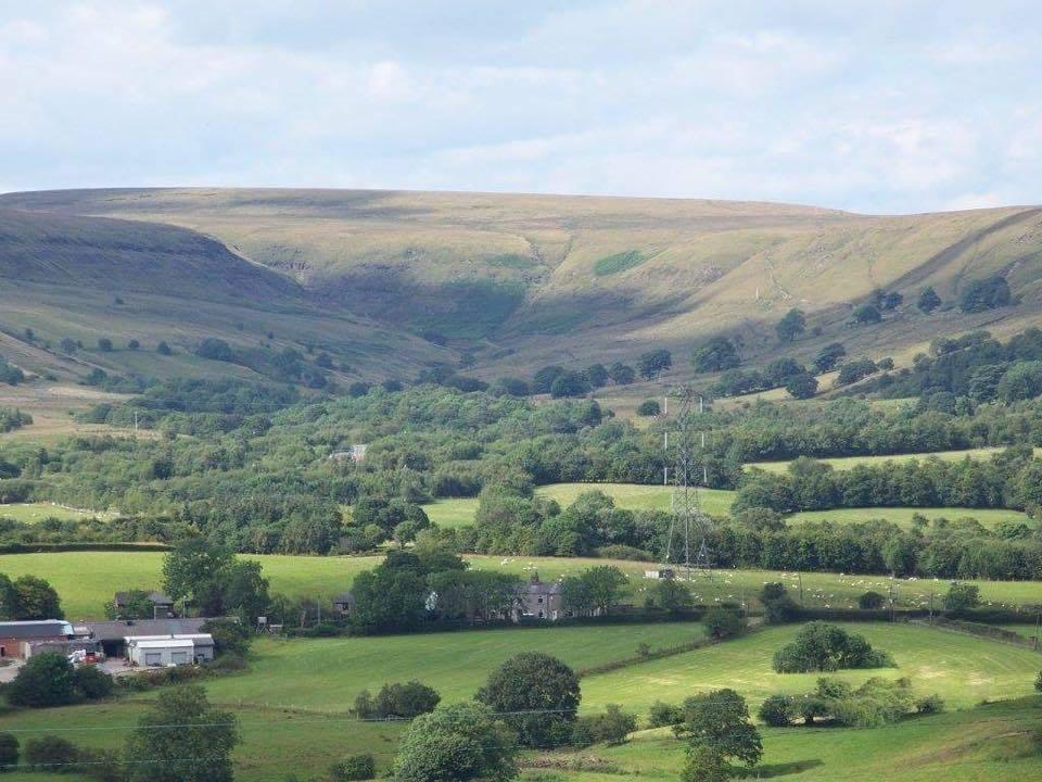
THE old routes north to south through the Irwell Valley clung to the moors above the swampy woodland below.
So it was that the ancient pilgrims travelling to Whalley Abbey used a high route that crossed over Holcombe Moor where the Pilgrim’s Stone now stands and followed a track along the moorland edge to Haslingden.
The track, Stake Lane, also became a pack horse route leading into Rossendale.
The pilgrims rested for a drink at the watering hole of Robin Hood’s Well, passed on this walk.
Robin Hood was a legendary name that turns up across many parts of the north of England.
Often his name was used in a derogatory mocking way to suggest old meaningless superstition on formerly holy spiritual sites.
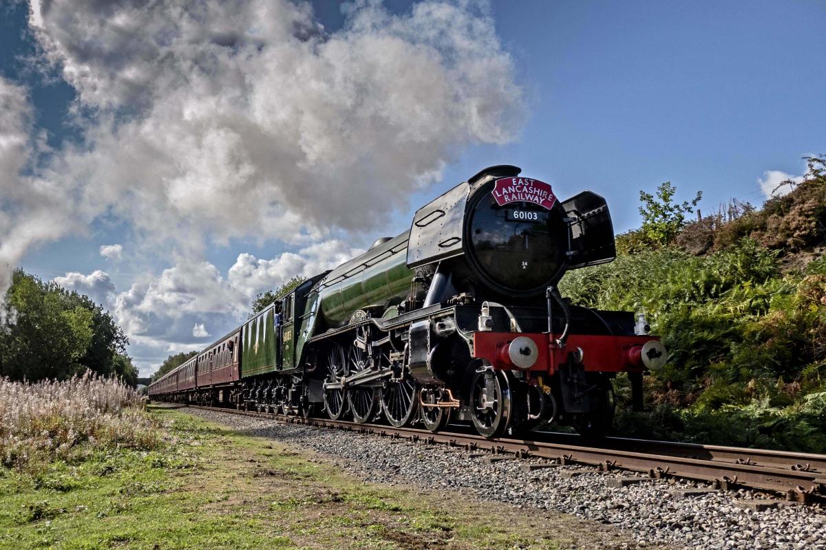
This walk returns along the Irwell Valley, which in the 19th century was transformed by the railway line using the natural gorge carved by the river.
The walk follows the river between the East Lancashire Railway and its redundant branch line, closed by Beeching in the 1960s., which ran from Stubbins Junction to Accrington via stations at Helmshore, Haslingden and Baxenden.
1. Join the lane (Alden Road) signed as a footpath on the right hand side of the Anacapri restaurant (formerly the White Horse pub). Follow it straight ahead for about ¼ mile (ignore the right fork) until a bridleway signpost is reached on the left by the gates to Dowry Head. This is at the point where the lane starts to wind uphill. Turn left up the drive and as it swings around to a gate leave it on the right joining the track, Moor Road, signed for Robin Hood’s Well.
2. Follow the walled track uphill onto the moor with a good view of Rossendale. Robin Hood’s Well is passed on the right just before a gate is reached. Go through the gate at the boundary of the Holcombe Moor estate but do not climb the moor any further, instead stick to the wall side track running along the edge of the moor, parallel to the Irwell Valley below. Head in the direction of Peel Tower and the track soon drops to a woodland reaching a stile/gate at a crossroads of paths.
3. Turn left here through a gate and follow a track downhill to reach the B6214 at another gate. Cross this with care and join the signed Rossendale Way path directly opposite at a gate. Join the first track on the right leading to a stile/gate. Cross this and continue with the field boundary on the left, crossing another stile and dropping towards woodland at a footpath signpost. Turn right and cross a stile, entering woodland then going down steps to cross a footbridge. Continue downstream with the beck on the left. The beck is crossed again lower down as is another stile. You leave the estate and take a left forking path leading to a gate by Buckden Barn.
4. Walk around the left hand side of the house and several signposts are reached indicating a National Cycleway Network route. Turn left here and follow the old railway through woodland heading north and crossing the River Irwell. When the path along the old line forks take the right fork downhill to join the Irwell Valley Way footpath sandwiched between the river on the left and the East Lancs Railway on the right. This soon reaches a lane at a bridge.
5. Turn left and cross the road bridge then turn right to continue north along the Irwell Valley Way now with the river to the immediate right. The path leads to the hamlet of Irwell Vale. Turn left up the hill by the children’s nursery at the corner of Milne Street. Continue steeply uphill to a gate and stile and join a track that crosses the old railway line and swings right. Continue to a farm at Raven Shore then take the track that forks left and leads back to the B6214. Turn right along it and the pavement leads downhill back to the Italian restaurant.
Nick Burton will be leading a walk, ‘Wainwright on the Yellow Hills’ on Saturday May 11
This walk retraces one of Alfred Wainwright’s earliest walks on the hills above Blackburn.


Comments: Our rules
We want our comments to be a lively and valuable part of our community - a place where readers can debate and engage with the most important local issues. The ability to comment on our stories is a privilege, not a right, however, and that privilege may be withdrawn if it is abused or misused.
Please report any comments that break our rules.
Read the rules here